Have you taken any road trips or hikes recently and wondered how high you were? Not that kind of high. We’re talking about altitude or height above sea level.
Many of us use Apple’s CarPlay for navigation while driving, so it’s a good bet Apple Maps or Google Maps is leading the way. Also, many car manufacturers, like Ford, Honda, Nissan, and Volvo, have Google Maps built into their newer models. It sure would be neat if Apple and Google Maps showed real-time elevation changes. However, neither offers it.
Nevertheless, you can sort of check your elevation using Apple and Google Maps on your iPhone. We’ll show you how. The quickest way to check your current elevation is with another built-in iPhone app: Compass.
Apple Maps
Apple Maps is the most clumsy of the three when checking elevation. As you scroll across that map and pinch and zoom, you’ll see elevation data displayed for specific landmarks, monuments, mountains, and national parks. The first image above shows the elevation of Mt. Washington in New Hampshire as 6,289 feet.
Apple Maps will also display elevation changes or “climb” along a route for walking or bicycling. Apple Maps does not provide any elevation change information for driving routes. Apple Maps doesn’t show your precise or approximate elevation unless you’re at or near a recognized point of interest like a landmark or mountain.
Google Maps
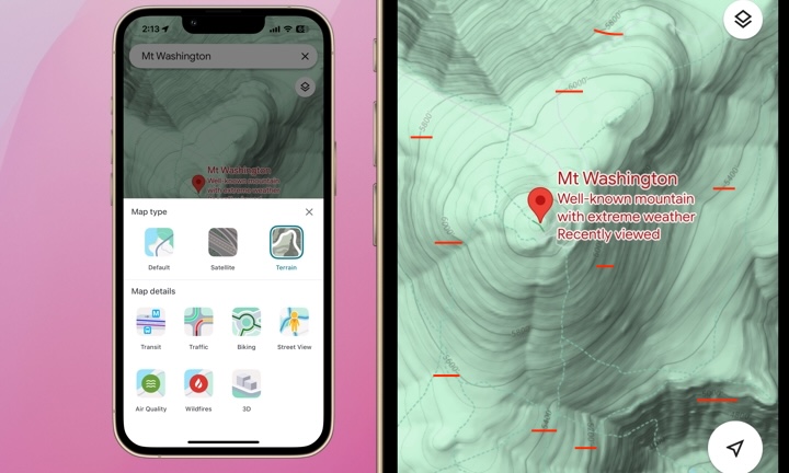
Google Maps shows more elevation data, but you must change the map type first. To do so, tap the icon in the top right of your screen beneath the search bar that looks like a circle with a diamond on top of a down arrow. You’ll see it in the image above. Tap the icon and select the Terrain view option. With Terrain view, as you scroll around the map and pinch and zoom at certain locations, you’ll see elevation indicated at various areas. The elevation indicators are underlined in red in the above image. I couldn’t replicate similar topographic contour lines and elevation data in Apple Maps.
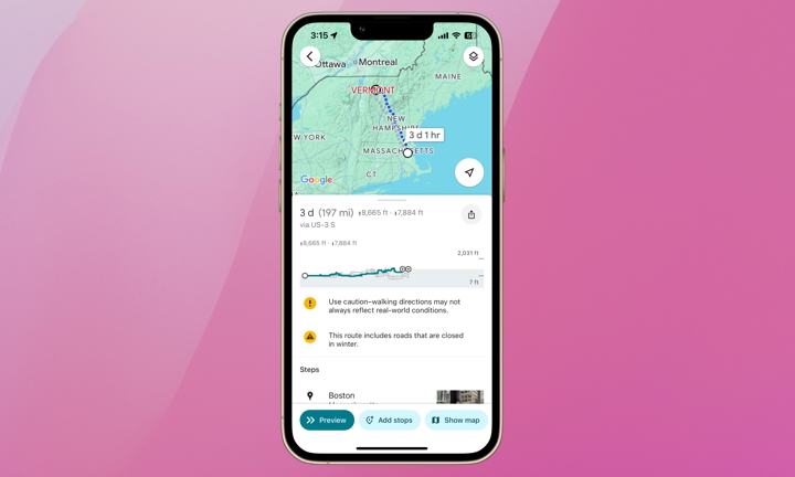
Like Apple Maps, Google Maps doesn’t show elevation changes along driving routes but does with walking and bicycling routes. Unlike Apple Maps, Google Maps shows increases in elevation as well as descents. This is definitely helpful information for cyclists.
Still, Google Maps falls short of providing elevation data in an easily accessible, practical, and fun way.
Apple’s Compass App
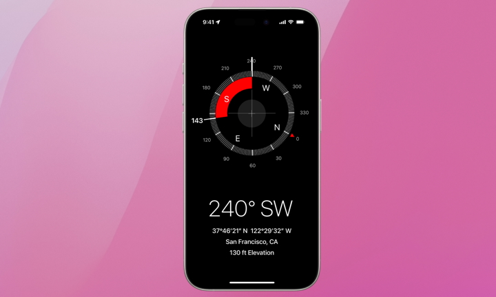
If you’re curious about your elevation, Apple’s Compass app has you covered. Compass shows your elevation in real-time, along with your bearing, coordinates, and location. The elevation measurement changed as I ran up and down the stairs of my house, so it should provide accurate and entertaining results on road trips.
Elevation tracking was first introduced in 2020 in the Compass app for the Apple Watch Series 6, which introduced an always-on altimeter. Compass for the iPhone started displaying elevation data with iOS 14 the same year, requiring an iPhone 6 or later as that was the oldest model to be equipped with a barometric sensor. For Compass to function correctly, you’ll need to have Location Services enabled, which you can check by going to: Settings > Privacy & Security > Location Services, then turn on Location Services.
While there are many hiking apps and altimeter apps available, it’s nice to know checking your elevation doesn’t require downloading another app. Whether planning a biking or hiking route or entertaining your kids on a road trip, these three apps have the elevation basics covered. We recommend exploring third-party app options for the more adventurous backpackers, bikers, and outdoorsmen.
global $wp;
. ‘/’;
?>